
The name, first
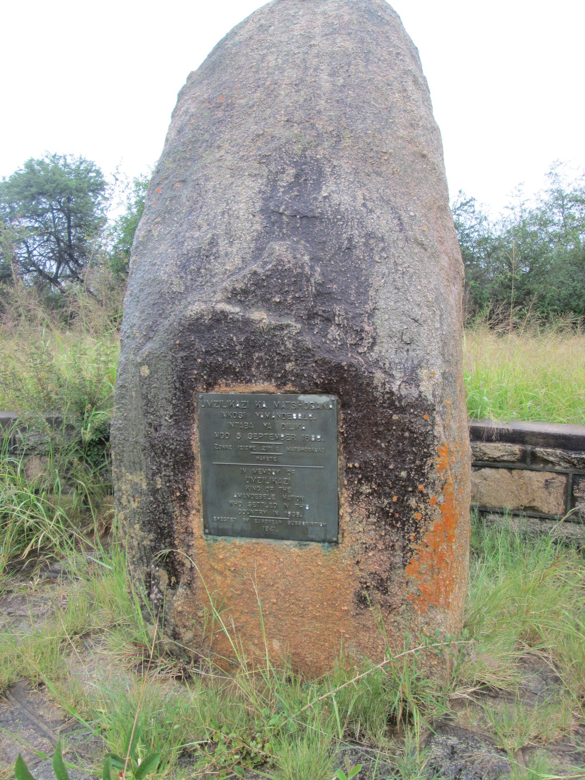
The Ndebele call them Matobo. The word means bald heads, and once you've seen the place you understand why. Domed granite, smooth as scalp, rising out of the bushveld in herds.
The story goes that Mzilikazi coined it. He heard people calling the rocks madombo, a general word for stones, and was unimpressed. Bald heads, he said. We will call them Matobo.
The colonial mouth could not quite hold it and the British wrote Matopos instead. That spelling is still on old maps, on the war memorials, and in the writing of every European who passed through between 1893 and 1980. We use Matobo, which is what the hills are called by the people who named them.
What you are standing on
It isn't desert and it isn't savannah. You come south from Bulawayo, and 50 km on, about fifty-five minutes, the country starts to lift. The bush thins. Then granite erupts out of the earth.
Whaleback domes the size of small mountains. Towers of stacked boulders. Rocks balanced on rocks balanced on other rocks, held there by nothing but their own weight and two point six billion years.
That number isn't decoration. The Matobo Batholith was emplaced into the crust during the Archaean, when the atmosphere had no free oxygen in it and the most complex thing alive was a cyanobacterium. The granite is older than breathing. Wind and frost have been working on it ever since. They peel it in onion-skin sheets and round it into the two shapes you see today. The smooth domes are bornhardts, after Wilhelm Bornhardt, who named them in 1900. The others are cluster kopjes, which look stacked by hand.
A granite ocean, with woodland in the troughs between the waves. Bring a hat, bring shoes you can walk in, and bring more time than you think, because the place doesn't open in a day.
Thirteen thousand years of paint
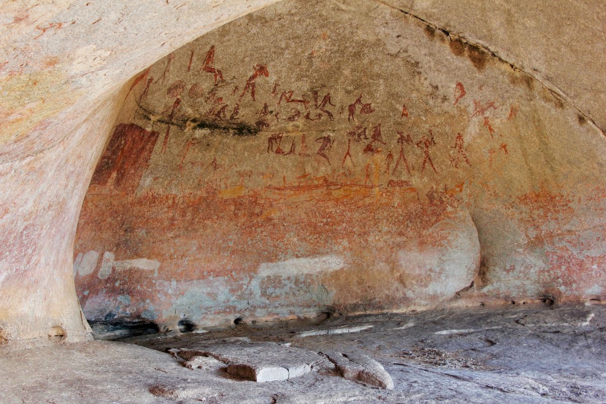
People have been here for as long as people have been anywhere. UNESCO puts occupation of these hills at half a million years. The deposits in Pomongwe Cave run back about sixteen thousand, and the oldest paintings, also at Pomongwe, date to around thirteen thousand.
Across the wider region archaeologists have catalogued roughly three thousand painted panels in more than seven hundred caves and shelters. There is no comparable concentration of hunter-gatherer art anywhere in southern Africa.
Eland, mostly. The eland was the spiritual heavyweight of San belief, the animal a healer became in trance. Giraffe with their necks in single confident strokes. Kudu, zebra, impala in herds. And people: hunters with bows, women with digging sticks, dancers in the postures of trance, and the half-human figures called therianthropes.
The pigments are red and yellow ochre, white kaolin, sometimes black manganese, ground and bound with animal fat or marrow. In some caves you can still make out individual brushstrokes.
The hills are sacred, and still in use
The painters at Inanke were practising religion. So was every Ndebele induna who climbed to Njelele in the dry months to ask for rain. So is every pilgrim who still makes that climb.
The faith is Mwari, also called Mwali, Mlimo or Ndzimu. It is a high-god religion older than Christianity in this part of the world and one of very few oracular traditions on the continent to survive intact. Its roots are Shona and Kalanga, possibly traceable to a fourteenth-century migration south. The central shrine is a cave called Njelele, known also as Matonjeni, or in Shona Mabweadziva, the place of spring waters.
Pilgrims go up between August and September, in the parched weeks before the rains. The custodian holds the role by hereditary line. He claps, and sings praises, and asks. A voice answers. What it says isn't for outside ears.
When Mzilikazi's Ndebele arrived in the 1830s they did the intelligent thing. They didn't replace the cult. They adopted it, gave the deity a name in their own language, and folded it into the kingdom. Six centuries of continuity, through colonial war, missionary campaigns, a liberation struggle and independence, and none of it broke. When UNESCO inscribed the hills in 2003, the living oracle was one of the named criteria. Not as a relic. As practice.
Most visitors don't go to Njelele, and don't need to. Photography there isn't appropriate. The sacred quality is in the granite, and standing on it for long enough does the work.
Mzilikazi
By most measures the second-greatest military leader in southern African history. Only Shaka outranks him, and Mzilikazi had been Shaka's general.
Born around 1790, of the Khumalo, son of Mashobane. He served Shaka, fought for Shaka, then broke from him in the late 1820s. There's more than one account of why, and they all involve cattle, pride, and the particular arithmetic of Zulu betrayal. He led his people north on one of the great migrations of the mfecane, fought the Voortrekkers at Vegkop in 1836, and settled the country between Bulawayo and the escarpment. Mthwakazi, he called it.
He chose the Matobo as the kingdom's spiritual centre for a reason any thoughtful king would recognise. It was already sacred. The oracle was here, the granite was here, and the water in the shaded crevices was here. He didn't have to persuade anybody the place mattered.
He died on 9 September 1868. The body lay in the royal dwelling for two months, guarded around the clock by twelve queens. Black oxen were killed for the spirits of the dead king and his ancestors. The burial began on the second of November and finished on the fourth, when he was placed inside a granite cave at Entumbane and the cave was sealed with stones.
He is still there. The grave is still visited. King Mzilikazi Day at Mhlahlandlela draws thousands every September, with the drums and the praise-song and the sense that something central to who the Ndebele are is anchored to that sealed cave.
The patrol that did not come back
Twenty-five years after that burial, a different sort of column came through. By 1893 the British South Africa Company had decided that Mzilikazi's son Lobengula needed bringing to heel. Lobengula had signed the Rudd Concession in 1888, believing he was granting limited mineral rights. It was reinterpreted in the Company's favour until a permission slip turned out to have been a deed of sale.
War followed. Lobengula went north. Major Patrick Forbes gave chase and sent ahead a thirty-four-man patrol under Major Allan Wilson.
On the third of December 1893 Wilson's patrol crossed the Shangani. The river rose in flood behind them. More than three thousand Ndebele warriors closed on them near the king's camp. Three men were sent back for relief and couldn't recross. They fought to the last cartridge and were killed to a man.
Rhodes wrote into his will that the patrol should be reinterred at the place he called the View of the World. In 1904 they were. The Shangani Memorial above their grave is Herbert Baker's, the same architect who built the Union Buildings in Pretoria, modelled on the Pedestal of Agrippa on the Acropolis. Thirty-three feet of granite cut from a kopje fifty yards away, with four bronze panels by John Tweed. The inscription reads: To Brave Men.
How a Boy Scout was born
In March 1896 the Second Matabele War broke out and the hills became the Ndebele stronghold. Caves painted ten thousand years earlier were now firing positions.
The British sent a colonel called Robert Baden-Powell to run reconnaissance into the granite. He was thirty-nine, ambitious and good at his job. In June he went out on a joint patrol with an American named Frederick Russell Burnham. Burnham was thirty-five, born in Minnesota, raised partly among the Lakota, and taught tracking by surviving veterans of the Apache Wars. He was Chief of Scouts for the British forces, and by every contemporary account the best bushman in either hemisphere.
On patrols that ran all night through country where one wrong sound meant a spear, Burnham taught Baden-Powell woodcraft. How to read tracks, read sky, read the absence of birdsong. They sat around small fires in the granite and talked, and somewhere in those conversations the idea took shape that this kind of self-reliance wasn't the property of soldiers. It could be taught to boys.
Baden-Powell came down off these hills wearing a campaign hat copied from Burnham's, carrying a kudu horn he had picked up in the rocks. In August 1907 he ran the first experimental camp on Brownsea Island and woke the boys each morning by blowing that horn. Scouting for Boys followed in 1908. There are more than fifty million Scouts now.
The hat, the horn and the idea all came down off these hills.
If you ever pitched a tent badly in a Scout uniform, your origin story runs through the Matobo.
The darker half of the same year
The other thing Burnham did in 1896 has never stopped being argued about. The rebellion was being held together, spiritually and tactically, by a senior priest of the Mwari cult called the Mlimo, broadcasting from a sacred cave in the western hills. Remove him, the Company reasoned, and the rebellion loses its nervous system.
Burnham and a Native Commissioner named Bonar Armstrong found the cave, tied their horses at a distance and crawled the last quarter-mile behind branches held in front of their faces. They waited inside until the priest entered and began the dance meant to make him proof against bullets. Burnham shot him below the heart.
The Ndebele have always said he killed the wrong man, and that the real Mlimo lived on. The Company said otherwise. A court of inquiry was appointed and its report has been lost.
What isn't disputed is what happened next. Rhodes rode up from the Cape, walked unarmed into the stronghold, and asked the indunas to talk. Three meetings followed, translated into Zulu two and a half hours at a stretch by a man named Johan Colenbrander. The chiefs squatted in council and laid out the grievances: mistreatment by Company officials, broken promises, cattle taken, land taken, dignity withheld. The talks ended in peace and the Bulawayo Field Force disbanded on the fourth of July 1896.
That story gets told in tones bordering on Sunday school. The fuller picture's harder. The peace was real. So was the assassination, and so was the betrayal that started the war. The Matobo holds all of it at once and asks you to look at it rather than past it.
The Englishman buried on sacred ground
Rhodes died on the twenty-sixth of March 1902 at his cottage at Muizenberg, of heart failure, aged forty-nine. His will was specific: bury me in the hills, on the granite dome I called the View of the World.
The Ndebele had a name for that dome already. Malindidzimu, the place of benevolent spirits. It had been sacred to the Mwari cult for centuries before any Englishman saw it.
The body came north by special train, eighteen hundred miles through the Karoo and across the Limpopo, and was buried on the tenth of April. The grave is a flat slab of granite set into the granite of the dome. One line: Here lie the remains of Cecil John Rhodes.
One thing to know if you stand there. As the coffin went down, the Ndebele gathered in the valley below gave him the Royal Salute, Bayete, which is reserved for dead kings of their own line. They did it by their own protocol, unprompted.
He didn't lie alone for long. Wilson and the Shangani Patrol came in 1904, a short walk away. Jameson was buried beside him later, and Sir Charles Coghlan, the first premier of Southern Rhodesia, after that.
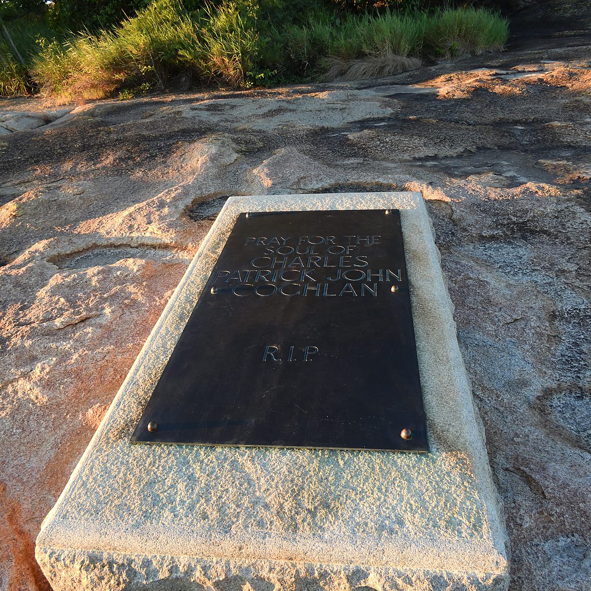
What you remember walking back down isn't any of the names. It's the granite, and the wind, and the view that gave the place its name.
Kipling wrote a poem
Kipling was in South Africa when Rhodes died, staying at a house Rhodes had built for visiting writers on the slopes of Table Mountain. He went to the cottage, helped in the ways one helps, and walked behind the coffin through Cape Town. He didn't come north.
He wrote a poem instead, called The Burial, and The Times printed it on the ninth of April 1902, the day before the burial, for the clergymen at the graveside to read aloud. It's in his high-Imperial register and parts of it haven't aged at all well. Its opening question survives the rest: what do you do when a great man dies, and the grief of the day fills only the day, because the figure who died was in the end a creature like anybody else.
The closing lines are carved under the bust of Rhodes at the memorial in Cape Town, three thousand kilometres south of where the body lies. The poem has been carried away from the hills. The body has not.
What lives here now
Set the human story down for a moment and look at the rock again.
The kopjes are full of rock hyrax, small rotund mammals that look like oversized guinea pigs and are, improbably, the closest living relatives of the elephant. Hyrax at that density feed two things. Leopard, which is why this is exceptional leopard country, and Verreaux's eagles, of which the Matobo holds the highest concentration anywhere in the world.
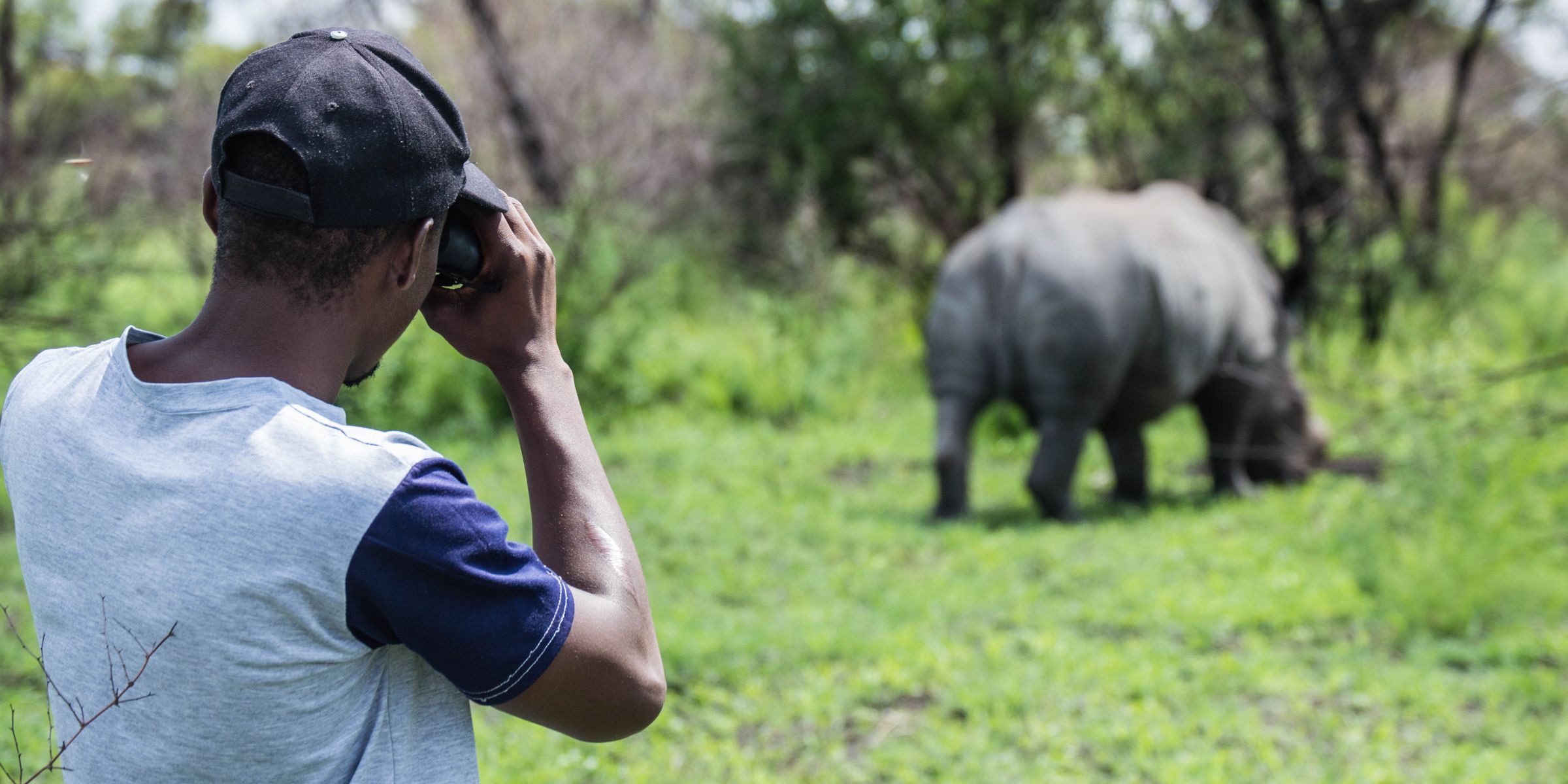
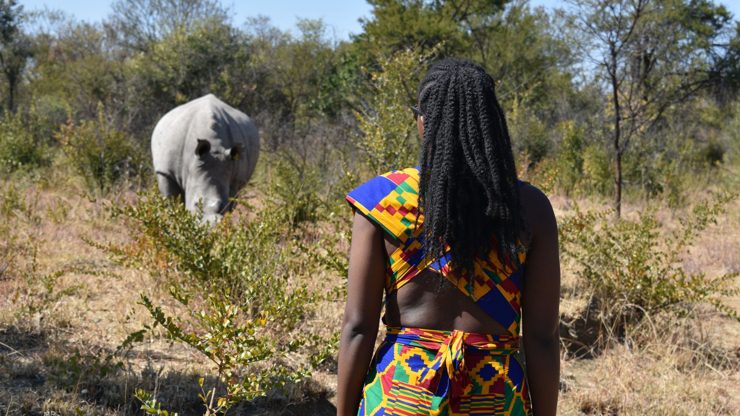
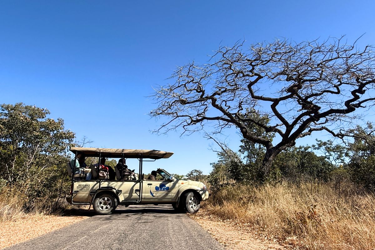
The leopard are nocturnal and you'll probably not see one. They'll see you. Beyond them there is white rhino, tracked on foot because there are no lion or elephant here to make that reckless, along with sable, giraffe, eland, zebra, wildebeest and kudu.
When to come, and how
- May to October
- Dry, cool mornings, thin bush and long sight lines. The best months for tracking on foot and the busiest of a park that is never busy.
- November to April
- Green, dramatic, and close to empty. Better light, better birding, harder tracking.
- Getting here
- 50 km south of Bulawayo, about fifty-five minutes, tarred most of the way with the last stretch on dirt. Joshua Mqabuko Nkomo International is the airport.
- The park
- Matobo National Park covers 424 km². It sits inside a World Heritage property of 2,050 km², inscribed in 2003.
- Park entry
- US$18 per international adult per day. SADC and Zimbabwean resident rates are lower.
- How long
- Three nights is the shape that works. A day trip shows you World's View and a cave. It doesn't show you the hills.
Stay inside the park if you can. The difference isn't the drive time. It's waking up in the landscape you came for instead of an hour away from it.